


PHOTOS, VIDEO: Flash flooding, severe storms, and major traffic disruptions hit Hungary on Sunday
Hungary was hit by a wave of severe weather on Sunday, as thunderstorms, torrential rainfall, and flash floods swept across large parts of the country. The sudden change in weather not only caused local flooding and road closures but also led to major traffic jams as holidaymakers attempted to return home from Lake Balaton ahead of the storm front.
Traffic chaos on roads from Balaton
Heavy traffic developed on both the northern and southern shores of Lake Balaton, with long queues forming on Routes 71 and 7. The M7 motorway, a major artery connecting the lake to Budapest, became severely congested in the early afternoon. According to Útinform, vehicles were moving slowly from around kilometre 112 near Zamárdi/Siófok West all the way to the Székesfehérvár section heading toward the capital.

The situation worsened due to an intense thunderstorm moving between Székesfehérvár and Budapest, affecting visibility and road conditions. Wet pavement and deteriorating visibility slowed traffic in both directions, including along the M1 motorway from Bicske toward the capital, Telex reported. The 710 main road and the Siófok–Székesfehérvár stretch of Route 7 were also heavily affected by increased traffic volume and weather conditions.
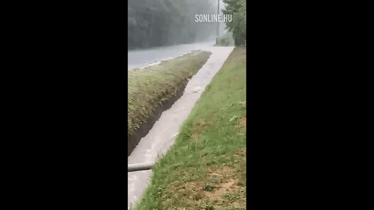
Flash flooding in Southern Hungary
In Somogy County, the long-awaited rainfall arrived with a vengeance. Overnight thunderstorms were followed by heavy morning downpours, which quickly overwhelmed drainage systems and led to flash flooding across multiple towns, including Csököly, Jákó, and Gige, Sonline wrote. In Kaposvár, locals were woken by thunder and torrential rain, with reports of up to 48.6 millimetres of rainfall in just one hour.
HungaroMet issued a second-level orange warning for Somogy County due to the risk of severe downpours, and local weather data showed over 60 millimetres of rain fell in some areas, with Visnyeszéplak and Somogysárd among the hardest hit. The slowly moving storm system, fuelled by a swirling air mass, created ideal conditions for repeated showers and flash flooding across the region.
Kaposvár and its surroundings were especially affected by supercells and slow-moving storm cells. Roads and residential areas turned into rivers as the saturated ground and stormwater systems could no longer absorb the sudden influx of water.
Nature reserves also affected
Even nature attractions like the Petesmalmi Otter Park were not spared. The park’s director, Márta Balogh, reported that access roads became impassable due to the storm, urging visitors to postpone their trips until conditions improve.
While the stormy weather has brought temporary relief from the heatwave, it has also highlighted the vulnerability of infrastructure and communities to sudden, extreme weather. Further rain is expected in the coming days, though forecasts suggest more stable, summer-like conditions will return in the second half of the week.
Read our weather forecast from today here – Relief is coming: Severe storms and hail hit Hungary as cooler weather arrives